How can we know whether and how much we should increase surface albedo and surface emissivity to ensure that our buildings reflect most of the solar radiation, while efficiently releasing any absorbed radiation?
This is a challenging question but before addressing it, we need to know the current surface albedo and emissivity values. Satellite imagery plays a unique role in this, allowing us to zoom out and to figure out how much sunlight buildings reflect and how well they release absorbed radiation.
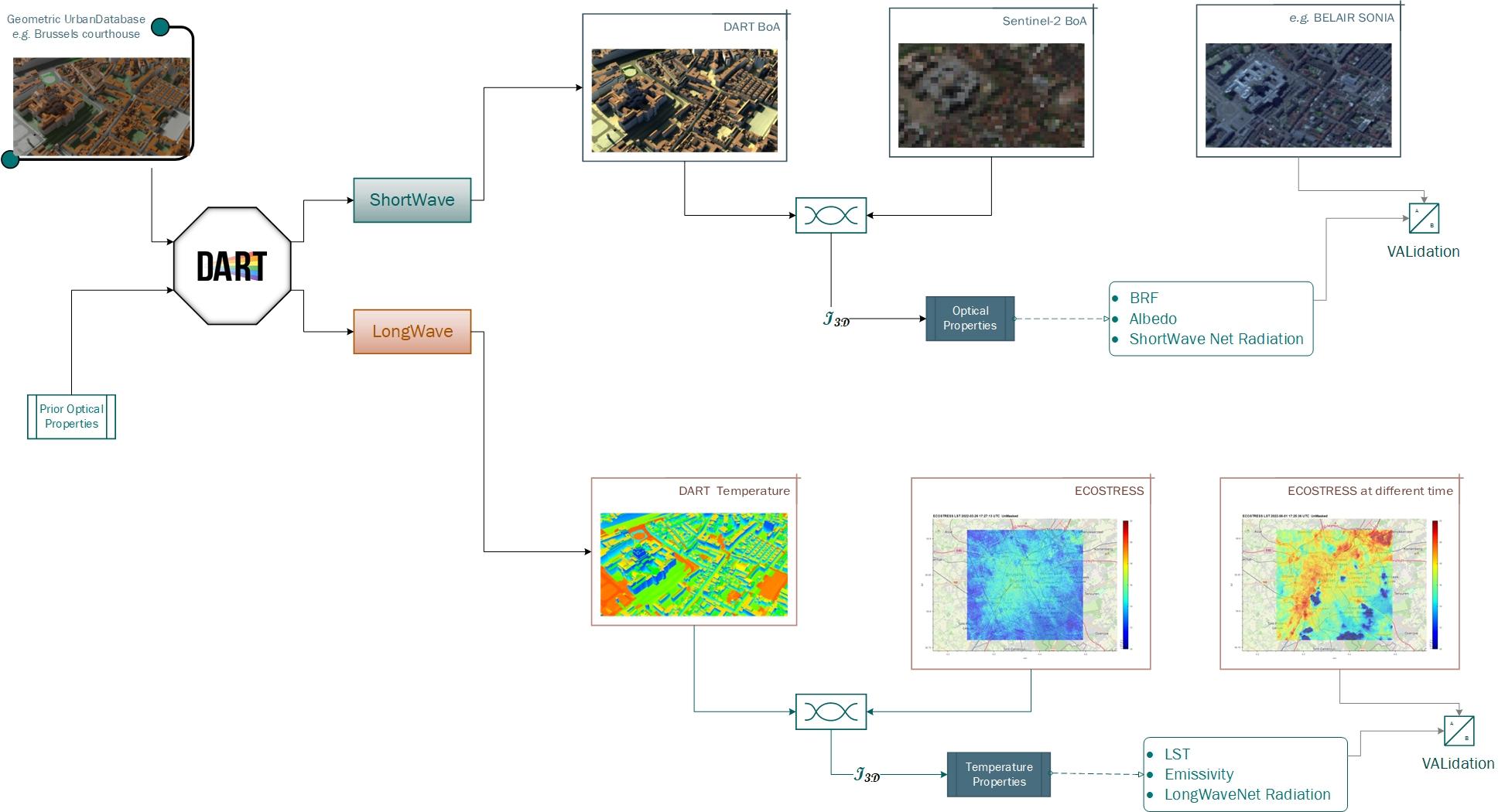
However, to retrieve those surface radiative parameters, we need to decouple the instrumental and experimental effects from the remote sensing signal. And we do that by modelling both the remote sensing signal and the instrumental and experimental effects via the state-of-the-art 3D radiative transfer code DART. This is achieved by running the SuaBe model inversion.
In simpler terms, imagine we have a satellite image and a detailed 3D model of the urban area (see top left panel in the above figure). We then ask ourselves: what are the real optical and temperature properties of each element of the urban canopy? By simulating how radiation propagates through the city 3D model under the same conditions as in the satellite data and changing in a robust and efficient way the optical/temperature properties, after some iterations we obtain an image that closely matches the real observations. The optical and temperature properties of that image are then considered the calibrated optical/temperature properties.
Once we retrieve the optical and temperature properties, we can model surface albedo at any time of the day and have access to surface emissivity for all surfaces across Brussels or any other city for which we have a geometric urban database.